
Florina - Macedonia (Greece)
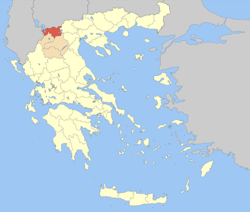
Florina is one of the thirteen prefectures in the Greek region of Macedonia in northern Greece. It is bordered to the north by the Former Yugoslav Republic of Macedonia and in the west by Albania. The capital of Florina is Florina town.
The prefecture of Florina in Greece is known for its unparalleled beauty with many mountains, rivers and lakes. While in Florina, you are only a half hour away from Thessaloniki by car. Coming from Thessaloniki, you can opt to take the route Thessaloniki-Edessa-Florina, which is the provincial route, which takes you through all kinds of beautiful towns and villages. Along this route you really taste the nature.
You can also take the Egnatia-route, which is the motorway towards Igoumenitsa and Siatista and drive through Kastoria to Florina. The latter route is faster, but the disadvantage is that you will not see many beautiful places.
Florina town lies on the River Sakoulevas. It is a typical northern Greek town that is located at 700 meters (2,300 ft) altitude above sea level and is surrounded by forests. About 20,000 people live in this town. Florina town is also accessible by train from Thessaloniki. The railway, used for the first time in the year 1893, made ​​Florina town flourish.
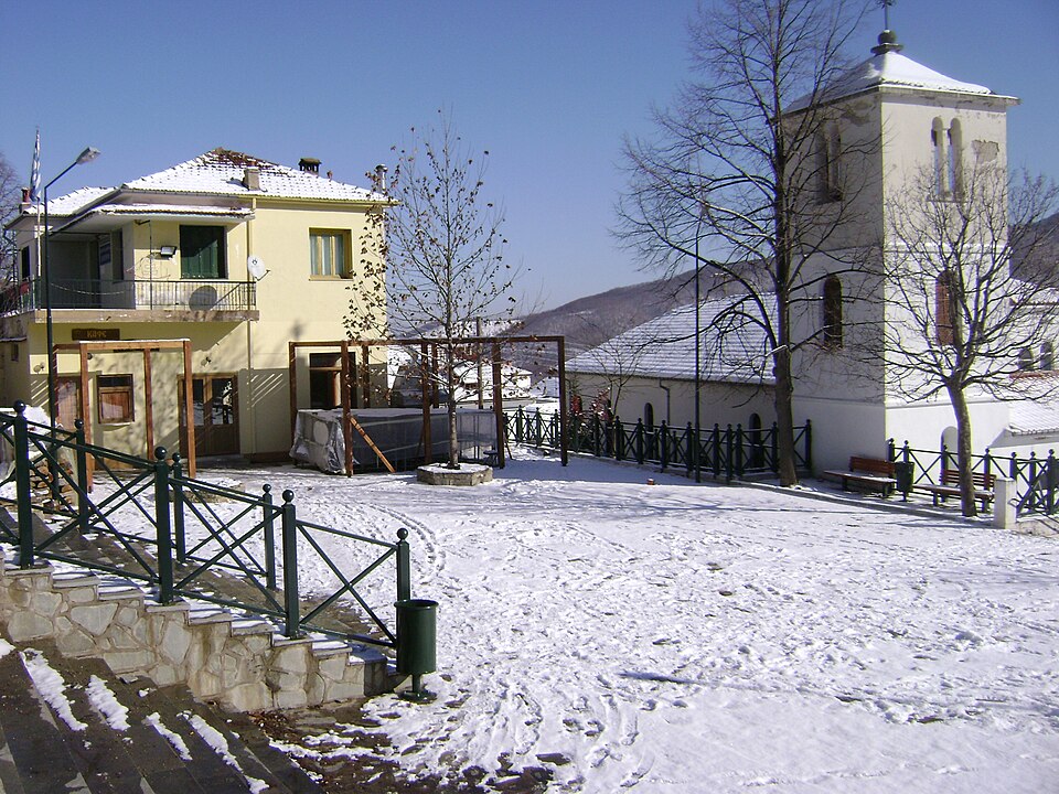
The climate of the whole area is one of the coldest of Greece. In winter there is a lot of snow and the temperature can get to 20 degrees below zero Celsius (-4o F). Summer daytime temperatures can be very warm, reaching above thirty, sometimes forty degrees Celsius (about 85-105o F).
Florina information
In recent decades, the prefecture of Florina has become a well developed tourist spot, especially through eco-tourism. In the winter, it attracts many winter tourists because at the ski area of Vigla, near the village Pisoderi, there are 10 ski slopes. There are many quaint, traditional villages such as the village Nimfeo located on a mountain at 1,300 meters (4,300 ft) altitude. The route to the village is fascinating. Along the way are several places where you can stop to take beautiful pictures. From above you can see a beautiful vast plain that is surrounded by high mountains. On the plain you can see several lakes such as Chimatitis, Zazari and slightly further Vegioritis and Petres.
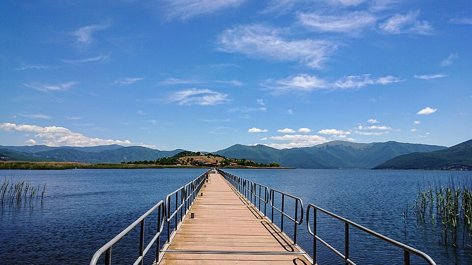
A main attractions of Florina are the lakes of Prespes – two lakes, large and small Prespa. These are located to the west of Florina town at an altitude of 800 meters (2,600 ft) above the sea level. These two lakes are situated next to each other and are separated by a narrow strip of land.
In the Great Prespa Lake is the border triangle between Greece-Albania-Former Yugoslav Republic of Macedonia. Small Prespa is mainly in Greek territory. A very small part of the lake is in Albania. In Small Prespa are two small islands, Agios Achillios and Vidronissi. Both Great and Small Prespa are specially protected natural areas where many species of birds reside.
Sights and tips prefecture Florina
-
- Florina city: the Archaeological Museum (near the train station) and the Museum of Modern Art.
- The islet Agios Achillios in Lake Mikri Prespa. This island is known for its Byzantine and Post-Byzantine ecclesiastical monuments.
- The town Amindeo, 41 kilometers (25 mi) southeast of Florina. One of the best wines in the world is produced in this area.
- Vegoritida, the lake and the town of Agios Panteleimon, which is an ancient settlement.
- The traditional mountain village Nimfeon (which is at 1,350 meters/4,400 ft) altitude above sea level, and 50 kilometers (30 mi) southeast of Florina City).
- The village Philotas beside Lake Vegoritida where the church of Agia Paraskevi is situated.
- The ski slopes of Vigla next to the traditional village Pisoderi.
- Prespes Lakes (Mikri and Megali Prespa).
- The fishing village Psarades on the shores of the Great (Megali) Prespa.
Περιφερειακή Ενότητα Φλώρινας είναι ένας από τους 51 νομούς της Ελλάδας, ο οποίος από το 2011 αποτελεί μία από τις 74 περιφερειακές ενότητες της χώρας και μία από τις τέσσερις που συγκροτούν την Περιφέρεια Δυτικής Μακεδονίας. Έχει πληθυσμό 44.880 κατοίκους, κατά την Απογραφή του 2021, αποτελώντας τη τρίτη μεγαλύτερη πληθυσμιακά Π.Ε. της Περιφέρειας Δυτικής Μακεδονίας μετά την Κοζάνη και την Καστοριά. Η έκταση της ανέρχεται σε 1.924 τετραγωνικά χιλιόμετρα.
Βρίσκεται στο βόρειο-βορειοδυτικό (ΒΒΔ) τμήμα της Ελλάδας και συνορεύει με τη Βόρεια Μακεδονία (Περιφέρεια Πελαγονίας) και την Αλβανία (Νομός Κορυτσάς) στα βόρεια και δυτικά αντίστοιχα, ενώ στα νότια συνορεύει με τις Περιφερειακές Ενότητες Κοζάνης και Καστοριάς και στα ανατολικά με την Περιφερειακή Ενότητα Πέλλας.
Πρωτεύουσα της περιφερειακής ενότητας είναι η Φλώρινα, η οποία αποτελεί την πλέον «παγωμένη» πόλη της Ελλάδας, με μέση ετήσια θερμοκρασία 11,2 βαθμούς Κελσίου. Κωμόπολη του νομού είναι το Αμύνταιο που βρίσκεται στα νότια, κοντά στις λίμνες Πετρών και Βεγορίτιδας. Κοντά στο Αμύνταιο βρίσκεται ο παραδοσιακός οικισμός του Νυμφαίου. Το Χιονοδρομικό Κέντρο Βίγλας Πισοδερίου βρίσκεται 19 χλμ. βορειοδυτικά της Φλώρινας και δυτικότερα οι Λίμνες Πρέσπες.
| Δήμος |
Έδρα |
Πληθυσμός(2021) |
| Αμυνταίου |
Αμύνταιο (Ιστορική έδρα: Νυμφαίο) |
14.169 |
| Πρεσπών |
Λαιμός |
1.211 |
| Φλώρινας |
Φλώρινα |
29.500 |
Add a review