Karpathos - Dodecanese (Greece)
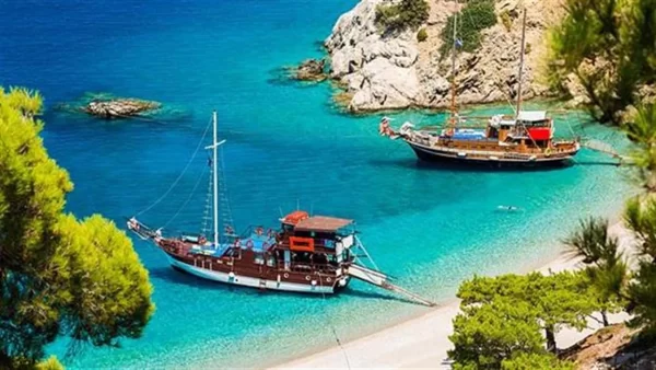
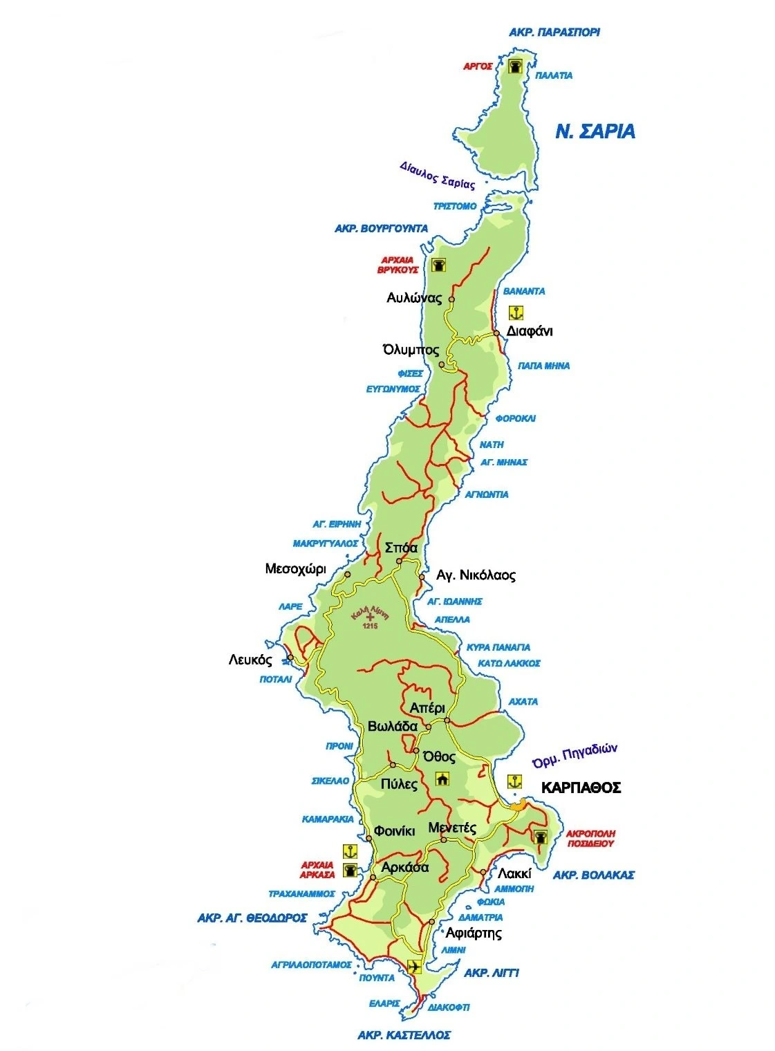
Karpathos is the second largest island of the Dodecanese and is located between Rhodes and Crete, in the southeast of the Aegean Sea. It is a mountainous island, whose highest peak is Kali Limni at 1,214 meters (nearly 4,000 feet). The island is rather green because of its forests, vineyards and olive groves. The southern part of Karpathos is relatively flat. That’s why most inhabitants of the island live there. On the island are dozens of fantastic sandy beaches.
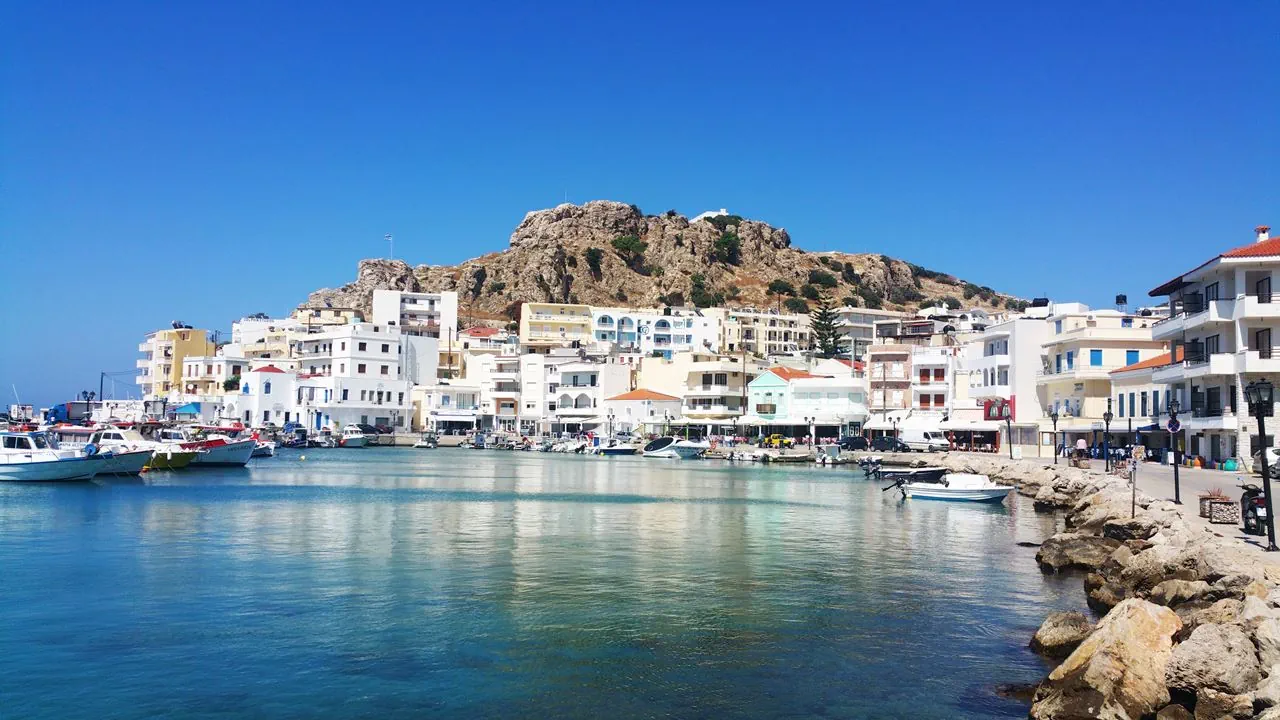
The capital of Karpathos is Pigadia. Pigadi means “well,” and in the past there were a significant number of wells in the area, hence the name. On maps Pigadia may be shown as Karpathos – they are used interchangeably. This city is built primarily with funds sent home by 20th century immigrants to the United States and does not reflect the local architectural style found in the older villages. It is built on the same place where in ancient times the port of Posidio was located.
On the island are many picturesque villages. Southwest of the capital is Menetes, whose history started after the Middle Ages. The village is known for its musicians and craftsmen of the Karpathian lyre (lyra). After Pigadia, Menetes is the largest village on Karpathos. The village Arkasa has been identified as the site of ancient Arkesia. There you can visit the ruins of an ancient Christian basilica from the fifth and sixth BC.
Discovering Karpathos
Thirteen kilometers (8 mi) to the northwest of Pigadia lay Othos, where an ethnological museum is located. Othos is built at 510 meters (1,700 foot) altitude. Volada, a little further north, is worth a visit. And in Mesochori you can tour a genuine antique Karpathian house with its mosaic floor. Citizens now realize the importance of maintaining their history and so many traditions are now being preserved. Another reason you have to visit Mesochori is its breathtaking sunset. Lefkos is a picturesque seaside village that is surrounded by a small pine grove.
Aperi is a lovely village that lies 8 kilometers (5 mi) northwest of Pigadia. Once it was the capital of the island. Further to the north is the traditional village of Olympos, which lies on the top and on the slopes of a hill. Many tourists come to Karpathos just to visit Olympos. It is one of the most beautiful villages in Greece. The highest point in the village is crowned with a tower. Even today, the traditional architecture is still intact and the people are proud that they have retained their heritage. Here, women still wear traditional costumes. Some speak a dialect containing several Dorian words.
The second harbor of Karpathos is located in Diafani. And in Spoa you will have a fantastic panoramic view of the sea.
The beaches of Karpathos
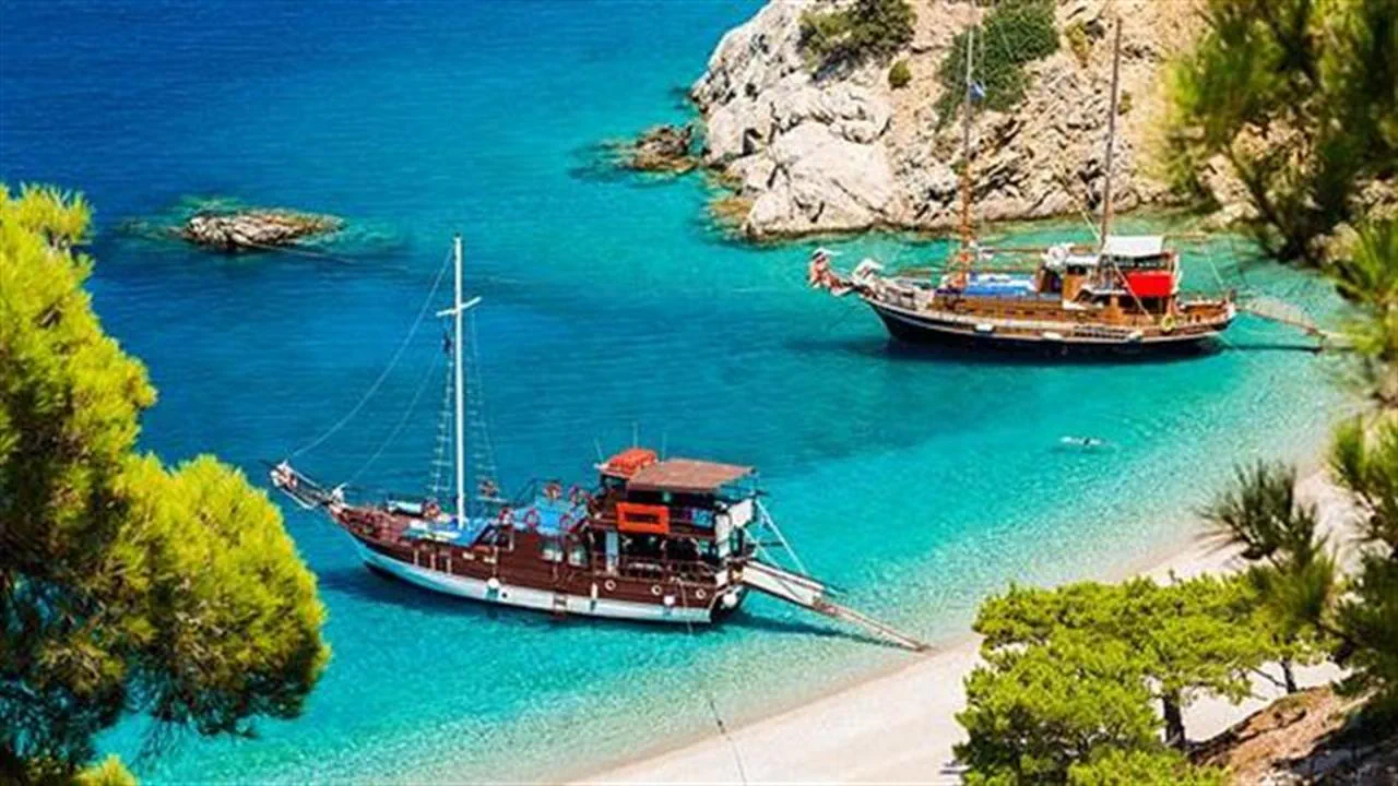
Karpathos has many beautiful beaches: Finiki and Afiartis in the southwest, Makriyialos to the southeast, Agia Irini on the west coast and Aghios Nikolaos in Arkasa. The coast at Amopi is beautiful. As a result, tourism here is growing significantly. The village lies against wooded hills, six kilometers (4 mi) south of the capital city, Pigadia. Finiki lies in the southwest of Karpathos, two kilometers (a little over a mile) north of Arkasa and 18 kilometers (11 mi) from Pigadia. It is a pretty fishing village with a natural harbor.
Local culinary specialties
When you are on holiday on Karpathos, it's definitely a good idea to try the local cuisine specialties of the island. Try Chilopites (a kind of pancake), Makarounes and Kouloures, all baked in traditional Karpathian ovens. In seafood restaurants, be sure to enjoy the Skouros or Karpathios caught in the sea of ​​Karpathos. Another specialty is Fakorizo, a mixture of lentils and rice. There are also delicious savory pastries such as Mizithropita (goat cheese pie), coleslaw sandwiches, Tiganites (small pancakes) and Kopeles (triangular vegetable rolls). Those who like sweets should try Baklava and Karpathian Sisamomeli (sesame with honey).
Kasos - Dodecanese (Greece)
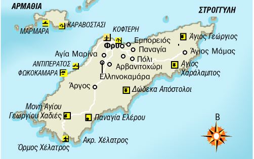
Kasos (Kassos) is the southernmost island of the Dodecanese. It is situated between Karpathos and Crete. It is a barren mountainous island with a steep rocky coastline and some beaches. Beaches are located in Fry, Emborios and Ammouda.
The capital of the island, Fry, is built on picturesque Bouka Bay. Fry is the main port of Kasos. The attraction you must visit on Kasos is the Cave of Sellai, 30 meters (nearly 100 feet) deep and 8 meters (26 feet) wide with impressive stalactites.
The first residents of Kasos seem to have been the Phoenicians. Homer reports that in his catalogue of the Greek cities that took part in the Trojan War. In the 18th century, Kasos had its own merchant fleet and became a prosperous island through trade. When its imposing fleet took part in the 1821 Greek War of Independence, the Turks took revenge. They destroyed the island and massacred its inhabitants in June, 1824. Only a small number of people survived that tragedy.
Sights Kasos (Kasos)
- Fry - the capital and only port of Kasos. Fry is a village built in 1840 by residents of Agia Marina.
- Agia Marina - a beautiful village with traditional houses. It is the island's largest village.
- The caves of Ellinokamara and Selai, not far from Agia Marina.
- Emporios - the ancient port of Kasos.
- Poli - the old capital of Kasos. Located 2 kilometers (a little more than a mile) from Fry and built on top of a hill. The view is magnificent.
- The islet Armathia, 3 kilometers (2 miles) from Fry. This islet has two beautiful beaches.
- The wind turbines in the town Dikefalos.
How to get to Kasos?
Kasos is connected by ferry with the harbors of Piraeus (Athens), Anafi, Halki, Heraklion (Crete), Karpathos, Milos, Rhodes, Santorini and Sitia (eastern Crete).
Περιφερειακή Ενότητα Καρπάθου - Ηρωϊκής Νήσου Κάσου
Ο Δήμος Καρπάθου είναι δήμος της περιφέρειας Νοτίου Αιγαίου που περιλαμβάνει τα νησιά Κάρπαθο και Σαρία και τις γειτονικές τους νησίδες. Δημιουργήθηκε με το Πρόγραμμα Καλλικράτης από την συνένωση του προϋπάρχοντος Καποδιστριακού Δήμου Καρπάθου με την ως τότε αυτοδιοίκητη Κοινότητα Ολύμπου Καρπάθου. Η έκταση του νέου Δήμου είναι 324,07 τ.χλμ. και ο πληθυσμός του 6.567 κάτοικοι σύμφωνα με την απογραφή του 2021. Έδρα του δήμου είναι η Κάρπαθος (Πηγάδια) και Ιστορική Έδρα η Όλυμπος.
Η Κάσος είναι ελληνικό νησί του νότιου Αιγαίου και το νοτιότερο από τα Δωδεκάνησα. Βρίσκεται ανάμεσα στην Κρήτη και στην Κάρπαθο. Έχει σχήμα περίπου ρομβοειδές επίμηκες με μέγιστο μήκος από το Ακρωτήρι Αυλάκι μέχρι το Ακρωτήρι Ακτή 19,8 χλμ. και μέγιστο πλάτος (στο μέσον σχεδόν της νήσου) 7,7 χλμ. Η έκταση της φθάνει τα 66,4 τ.χλμ. και έχει μήκος ακτών 59 χλμ. Το νησί βρέχεται ολόγυρα από το Καρπάθιο Πέλαγος.
Η πρωτεύουσα του νησιού είναι το Φρυ ενώ τα υπόλοιπα χωριά είναι η Αγία Μαρίνα, το Αρβανιτοχώρι, ο Εμπορειός, η Παναγία, και το Πόλι. Υψηλότερες κορυφές των βουνών της είναι ο Πρίωνας (601 μ.), ο Περίολας (504 μ.) και ο Κόρακας (494 μ.) και ακολουθούν το Σύσφι, οι Τρούλλες, τα Δώματα, ο Άη Γιώργης και η Μυρτώ.


Add a review